hidden
|
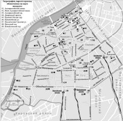
Admiralteisky District
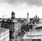
ADMIRALTEISKY DISTRICT, (Admiralty) an administrative territorial unit of St. Petersburg (Its territory administration is located at 10 Izmailovsky Avenue), is one of the central districts of the city
|
|
|
|
|
hidden
|
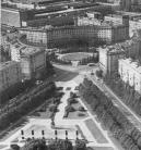
Admiralteyskaya Side
ADMIRALTEYSKAYA SIDE, a historical name of the central part of St. Petersburg bound on the north by the Neva river and on the south by the Moika River. Formed in the early 18th century when the General Admiralty
|
|
|
|
|
hidden
|
Alexandrovskaya (Kurortny District)
ALEXANDROVSKAYA, locality in the southern part of Sestroretsk, bordering on Gorsky Stream on the south and Lake Sestroretsky Razliv on the north, taking up either side of Primorskoe Freeway
|
|
|
|
|
hidden
|
Alexandrovskaya (Pushkinsky District)
ALEXANDROVSKAYA, municipal unit within the structure of Pushkinsky District of St. Petersburg, located on the banks of the Kuzminka River. The settlement also comprises a railway station of the same name
|
|
|
|
|
hidden
|
Alexandrovskoe, region
ALEXANDROVSKOE, an area to the south-east of St. Petersburg, confined by Zaporozhskaya Street, Moskovskaya Line of Oktyabrskaya Railway, Alexandrovskoy Fermy Avenue, Novo-Alexandrovskaya Street and the Neva River
|
|
|
|
|
hidden
|
Alexandrovsky Parade Ground
ALEXANDROVSKY PARADE GROUND, the historical name of the territory in the south-west of the city center, around the Alexander Nevsky Lavra, north of Obvodnoy Canal and west of the Monastyrka River
|
|
|
|
|
hidden
|
Aviagorodok
AVIAGORODOK, an area in St. Petersburg's Moskovsky District, in the southern part of the city, west of Pulkovskoe Highway and near the Airport Railway Station. In 1931-41, it was Leningrad's main airport and included a living bloc for its staff
|
|
|
|
|
hidden
|
Avtovo
AVTOVO, an area in the southwest part of St. Petersburg, bordered by the Krasnenkaya River on the south and Komsomolskaya Square on the north. The name origin traces back to the Finnish village of Autovo (Auktovo)
|
|
|
|
|
hidden
|
Belevskoe Field
BELEVSKOE FIELD, an area to the south-east of St. Petersburg, confined with Alexandrovskoy Fermy Avenue, Sedova Street, Krasnykh Zor Boulevard and Moskovskaya Line of Oktyabrskaya Railway
|
|
|
|
|
hidden
|
Beloostrov
BELOOSTROV, a municipal unit (since 1998) forming a part of Kurortny District of St. Petersburg, 30 km to the north-west of the city centre, on the banks of the Sestra River, 3 km upstream from the place where it flows into Sestroretsky Razliv Lake
|
|
|
|
|
hidden
|
Bolshaya Okhta, locality
BOLSHAYA OKHTA, a locality in the east of St. Petersburg, on the right bank of the Neva River, surrounded by the Okhta River, Energetikov Avenue and Revolyutsii Freeway
|
|
|
|
|
hidden
|
Chekushi
CHEKUSHI is an area located in the south-western part of Vasilievsky Island. Its name is known from the first part of the 18th century and is related to "chekushi" or "tokmochi"
|
|
|
|
|
hidden
|
City Sides (entry)
CITY SIDES (St. Petersburg City Sides), a general name of St. Petersburg historical districts, which emerged in the early 18th century. Determined by St. Petersburg's location on different banks (sides) of the Neva River
|
|
|
|
|
hidden
|
Dachnoe
DACHNOE, an area in the south-west part of St. Petersburg, between Krasnenkaya River, Baltiiskaya Railway Line, Stachek Avenue and Alexandrino Forest Park. In the north, it borders Avtovo, in the south-west Ulyanka
|
|
|
|
|
hidden
|
Dibuny, area
DIBUNY, an area in the west part of Pesochny municipal unit, on the right bank of the Chernaya River. There is a railway station of the same name. The toponym originates from the Old Russian word "dybun" meaning swamp or bog
|
|
|
|
|
hidden
|
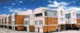
Dolgoe Lake
DOLGOE LAKE, one of the largest residential areas. Located in the North-West of St. Petersburg, it neighbours Kolomyagi in the east, Commandant's Aerodrome in the southeast and Yuntolovo Forest Estate in the west
|
|
|
|
|
hidden
|
Dyuny (Dunes), area
DYUNY (Dunes), an area in the north part of Sestroretsk, on the coast of the Gulf of Finland. The name is conditioned by the terrain structure: sand-dunes covered with a pine forest
|
|
|
|
|
hidden
|
Five Corners
FIVE CORNERS, a traditional informal name of the crossroads, formed by Zagorodny Avenue, Lomonosova Street (former Chernyshev Lane), Rubinstein Street (former Troitskaya Street) and Razyezzhaya Street. Appeared in the 1760s
|
|
|
|
|
hidden
|
Frunzensky District
FRUNZENSKY DISTRICT, an administrative and territorial unit of St. Petersburg, with its administration located at 46 Prazhskaya Street. Formed in 1936, it was named in honour of Soviet statesman and military commander M. V
|
|
|
|
|
hidden
|
Gatchina, town
GATCHINA (in 1923-1927 Trotsk, in 1927-1944 Krasnogvardeisk), a town in Leningrad Region, 45 km to the south from St. Petersburg. Known since 1499 as Khotchino village, since the early 18th century - the Gatchinskaya farm-stead
|
|
|
|
|
hidden
|
Gorelovo, locality
GORELOVO, an area in the south-west of St. Petersburg, along Tallinskoe Freeway, to the north of Krasnoe Selo. It was named after a village of the same name. In the 19th - early 20th centuries
|
|
|
|
|
hidden
|
Gorskaya
GORSKAYA, locality in the southern part of Sestroretsk, east of Primorskoe Freeway. The territory incorporates a railway station of the same name within the railway line linking St. Petersburg and Sestroretsk and a summer settlement
|
|
|
|
|
hidden
|
Grazhdanka
GRAZHDANKA, an area to the north of St. Petersburg. Named after a German settlement (sometimes, referred to as Gorozhanka) that was formed in the second half of the 18th century on Staraya Murinskaya Road (the present-day site of Favorskogo Street)
|
|
|
|
|
hidden
|
Harbour
HARBOUR is an area in the western part of Vasilievsky Island. Soon after the foundation of St. Petersburg, earthworks and the artillery battery were put up here to protect the entrance to the Bolshaya Neva River
|
|
|
|
|
hidden
|
Ingermanland
INGERMANLAND (Swedish variant, Ingermanland; Russian variant, Izhorskaya Zemlya, or Ingria), a historic-cultural region including the Neva region, the Gulf of Finland shore, and the southwestern of Ladoga Region
|
|
|
|
|
hidden
|
Kalininsky District
KALININSKY DISTRICT is an administrative territorial unit of St. Petersburg. (Its territory administration is located at 13 Arsenalnaya Embankment.) The district was named in honour of Mikhail Kalinin in 1946
|
|
|
|
|
hidden
|
Kamenka, area
KAMENKA (Bolshaya Kamenka, until 1930 - Koloniya Kamenka "Kamenka Colony"), the former village in the north-west of St. Petersburg, north of Yuntolovskaya Forest Estate, and north-west of the region of large-scale residential building of Dolgoe Lake
|
|
|
|
|
hidden
|
Kantsevskaya Side
KANTSEVSKAYA Side, the name of the territory on the right bank of the Okhta River, at the confluence of the Okhta and the Neva, that was current in the 18th century. It comes from the Russian name of the former Swedish fortress Nyenschantz - Kantsi
|
|
|
|
|
hidden
|
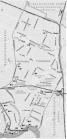
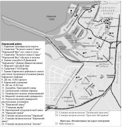
Kirovsky District
KIROVSKY DISTRICT is an administrative territorial unit of St. Petersburg. (Its territory administration is located at 18 Stachek Avenue). The district was named in honour of Sergey Kirov in 1934. Its present-day borders were established in 1973
|
|
|
|
|
hidden
|
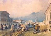
Kolomna
KOLOMNA, a historical district in the west part of St. Petersburg, between the Bolshaya Neva, Moika, Fontanka and Kryukov Canal. The name appeared in the early 18th century, most likely, on account of working people from the town of Kolomna
|
|
|
|
|