Addresses
/
Volkhonskoe Freeway/Saint Petersburg, city
hidden
|
Petrodvortsovy District
PETRODVORTSOVY DISTRICT, an administrative-territorial entity within St. Petersburg, with the territorial administration located at 7 Kalininskaya Street, Petrodvorets. The district is named after the town of Petrodvorets, the district centre
|
|
|
|
|
hidden
|
Sewerage System
SEWERAGE SYSTEM, wastewater treatment facilities. In the first quarter of the 18th century as the city territory grew, it was drained, and the system for discharge of surface water was built in the shape of plank-secured ditches along the city
|
|
|
|
|
hidden
|
Volodarsky, village
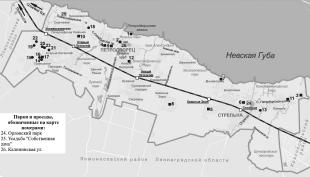
VOLODARSKY VILLAGE (until 1918 - Alexandrovsky village), an area 18 km south-west from the centre of St. Petersburg. Volkhonskoe Freeway joins it with Strelna and Pushkin, while Krasnoselskoe Freeway connects it with Krasnoe Selo
|
|
|
|
|
hidden
|
Yuzhnoe Cemetery
YUZHNOE CEMETERY (Volkhonskoe Freeway, suburb area). The largest functioning St. Petersburg cemetery. Its area covers 278 hectares. The cemetery was opened in 1971. The Yuzhnoe Cemetery is outside city limits and can be expanded
|
|
|
|
|