Addresses
/
Slavy Ave/Saint Petersburg, city
hidden
|
Central Ring Route
CENTRAL RING ROUTE, motor transport system, one of the main lines of St. Petersburg. The creation of Central Ring Route was to eliminate transit freight transport from the city
|
|
|
|
|
hidden
|
Frunzensky District
FRUNZENSKY DISTRICT, an administrative and territorial unit of St. Petersburg, with its administration located at 46 Prazhskaya Street. Formed in 1936, it was named in honour of Soviet statesman and military commander M. V
|
|
|
|
|
hidden
|
Internationalistov Park
INTERNATIONALISTOV PARK is situated in the south part of St. Petersburg, in Kupchino, between Slavy Avenue, Yuzhnoe Freeway, Bukharestskaya Street and Sofiiskaya Street
|
|
|
|
|
hidden
|
Relief
RELIEF. Despite having a general plain character, its flatness and large built up areas, the relief of St. Petersburg is diverse and full of contrasts. The highest peaks in the southwest of the city reach 176 meters
|
|
|
|
|
hidden
|
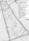
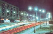
Slavy Avenue
SLAVY AVENUE, between Vitebskaya Railway Line and Moskovskaya Railway Line. It was named in 1964 in honour of the military victories and feats of labour of Leningrad citizens
|
|
|
|
|
|
hidden
|
|
hidden
|