|
|
|
Persons
/
Schaub Vasily Vasilievich
architect
hidden
|
Schaub V.V., (1861-1934), architect.
SCHAUB Vasily Vasilyevich (1861, St. Petersburg - 1934, Leningrad), architect, Member of the Academy of Architecture (1892). Graduated from the Academy of Fine Arts (1885). He was an architect for insurance societies and charitable institutions
|
|
|
|
|
hidden
|
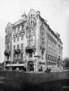
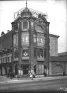
Art Nouveau
ART NOUVEAU (from the French for "new art"), the style in architecture and art of the late19th - early 20th centuries. In St. Petersburg, it developed from the end of 1890s through to the early 1910s
|
|
|
|
|
hidden
|
Fonarny Lane
FONARNY LANE, between the Moika River Embankment and Griboedova Canal. The lane was laid in the 1730s and named Golitsyn Lane in 1739, after the last name of a house-owner, Prince M. Golitsyn
|
|
|
|
|
hidden
|
Grazhdanskaya Street
GRAZHDANSKAYA STREET, running from Griboedova Canal to Voznesensky Avenue. In the 1730s, it was known as Third Perevedenskaya Street, and called Srednaya Meshchanskaya Street from 1739 to 1882, then called simply Meshchanskaya Street
|
|
|
|
|
hidden
|
Kamennoostrovsky Avenue
KAMENNOOSTROVSKY AVENUE, located between Troitskaya Square and the Bolshaya Nevka River Embankment. The main thoroughfare joining the city centre and the Petrogradskaya Side with Aptekarsky Island and Kamenny Island
|
|
|
|
|
hidden
|
Krasnoarmeiskie Streets, First - Thirteenth
KRASNOARMEISKAYA STREETS, FIRST - THIRTEENTH (until 1923, the First - Twelfth Roty, and Zarotnaya Street). First - Seventh Krasnoarmeiskaya Streets are located between Moskovsky Avenue and Izmailovsky Avenue; Eighth Krasnoarmeiskaya Street
|
|
|
|
|
hidden
|
Lakhta, locality
LAKHTA, a landmark northwest of Saint Petersburg, on the northern coast of the Gulf of Finland, in the vicinity of a cognominal railway station and Lake Lakhta; neighbours Olgino on the West, and Staraya Derevnya on the East
|
|
|
|
|
hidden
|
Leo Tolstoy Square
LEO TOLSTOY SQUARE, at the intersection of Bolshoy Avenue of Petrogradskaya Side and Kamennoostrovsky Avenue. The square was named in the 1920s after the neighbouring street of the same name (since 1798 - Arkhiereiskaya Square
|
|
|
|
|
hidden
|
Lines of Vasilievsky Island (entry)
LINES Of VASILIEVSKY ISLAND, the historical name of a number of parallel streets that intersect Vasilievsky Island from the south to the north: First to Twenty-Ninth Lines, Birzhevaya Line, Kozhevennaya Line, Kosaya Line, Mendeleevskaya Line
|
|
|
|
|
hidden
|
Maly Avenue of Petrogradskaya Side
MALY AVENUE Of PETROGRADSKAYA SIDE [in the 1770s - Malaya Perspektiva, in 1941-91 - Shchorsa Avenue, after N.A. Shchors a participant of the Civil War (1895-1919)], from Zhdanovskaya Embankment to Shevchenko Square and Kamennoostrovsky Avenue
|
|
|
|
|
hidden
|
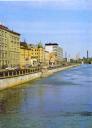
Petrogradskaya Embankment
PETROGRADSKAYA EMBANKMENT known as Peterburgskaya Embankment until 1914. It lies between Petrovskaya Embankment and Karpovka River Embankment on the left bank of the Neva River in the east of Petrogradsky Island (hence the name)
|
|
|
|
|
|
hidden
|
|
hidden
|
|
hidden
|
|
hidden
|
|
hidden
|
|
hidden
|
|
hidden
|
|
hidden
|
|