Authors
/
hidden
|
Entuziastov Avenue
ENTUZIASTOV AVENUE, from Peredovikov Street to Kommuny Street, in the area of Rzhevka - Porokhovye. The avenue was laid in the 1960s as a part of the central semicircular thoroughfare
|
|
|
|
|
hidden
|
Farforovskaya Street
FARFOROVSKAYA STREET, a street running from Obukhovskoy Oborony Avenue to Sedova Street. Laid out in the second half of the 19th century and given the name Bolshaya Shchemilovka Street after the cognominal Shchemilovka township
|
|
|
|
|
hidden
|
Fenomen Peterburga (Petersburg Phenomenon), publication series
FENOMEN PETERBURGA (Petersburg Phenomenon), a collection of scientific publications of the International Conference organised by the Petersburg Phenomenon Scientific, Cultural and Educational Centre in association with St
|
|
|
|
|
hidden
|
Fonarny Lane
FONARNY LANE, between the Moika River Embankment and Griboedova Canal. The lane was laid in the 1730s and named Golitsyn Lane in 1739, after the last name of a house-owner, Prince M. Golitsyn
|
|
|
|
|
hidden
|
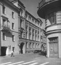
Galernaya Street
GALERNAYA STREET, runs from Dekabristov Square to Novo-Admiralteysky Canal Embankment crossing Truda Square. In 1738, it was known as Isaakievskaya Street (after St
|
|
|
|
|
hidden
|
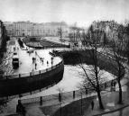
Galley Harbour
GALLEY HARBOUR is an engineering monument from the early 18th century. A rectangular pool located in the western part of Vasilievsky Island in the 18th - early 19th centuries served as a base for naval rowing vessels (galleys, hence the name)
|
|
|
|
|
hidden
|
Goncharnaya Street
GONCHARNAYA STREET, from Vosstaniya Square to Poltavskaya Street. Known as Novaya Pershpektivnaya Road in the mid-18th century, assuming its present-day name in the 1780s after the potteries and potters' settlements that developed here
|
|
|
|
|
hidden
|
Gorokhovaya Street
GOROKHOVAYA STREET, runs from Admiralteysky Avenue to Zagorodny Avenue, crossing the Moika River (Krasny Bridge), Griboedova Canal (Kamenny Bridge) and the Fontanka River (Semenovsky Bridge)
|
|
|
|
|
hidden
|
Grafsky Lane
GRAFSKY LANE, running from Fontanka River Embankment to Vladimirsky Avenue. Called Golovin Lane from 1739 to the late 18th century; in 1923 it assumed the name Proletarsky Lane, and, in 1964, was renamed Marii Ulyanovoy Street (in honour of M.I
|
|
|
|
|
hidden
|
Grazhdanskaya Street
GRAZHDANSKAYA STREET, running from Griboedova Canal to Voznesensky Avenue. In the 1730s, it was known as Third Perevedenskaya Street, and called Srednaya Meshchanskaya Street from 1739 to 1882, then called simply Meshchanskaya Street
|
|
|
|
|
hidden
|
Grazhdansky Avenue
GRAZHDANSKY AVENUE, running from Nepokorennykh Avenue to Suzdalsky Avenue. The avenue was named after the locality Grazhdanka. Originally called Road to Gorozhanka Village (name known since 1817)
|
|
|
|
|
hidden
|
Grechesky Avenue
GRECHESKY AVENUE, running from Second Sovetskaya Street to Vilensky Lane. The avenue was laid in the 1860s and assumed its name in 1871 after the Greek Church of St. Demetrius of Thessalonica
|
|
|
|
|
hidden
|
Griboyedova Canal
GRIBOYEDOVA CANAL (the Ekaterininsky Canal in 1767-1923) starts from the Moika River at the Field of Mars and flows into the Fontanka River at Malo-Kalinkin Bridge. It is 5 km long and 32 meters wide with water flow of 3.1 - 3.4 m3
|
|
|
|
|
hidden
|
Grivtsova Lane
GRIVTSOVA LANE, running from the Moyka River Embankment to Sennaya Square. Starting in 1739, the lane was known as Malaya Sarskaya Street. From the 1770s to 1871, the section extending to the Ekaterininsky Canal was called Konny Lane
|
|
|
|
|
hidden
|
Irinovsky Avenue
IRINOVSKY AVENUE, running from Boksitogorskaya Street to Kommuny Street, one of the major arteries of the Porokhovye area. The avenue runs parallel to the former Irinovskaya Railroad line (hence the name)
|
|
|
|
|
hidden
|
Ivanovskaya Street
IVANOVSKAYA STREET, running from Obukhovskoy Oborony Avenue to the Moskovskaya Line of the Oktyabrskaya Railroad, part of the Central Arched Line. Named in the 1890s after a house-owner
|
|
|
|
|
hidden
|
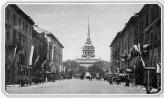
Izmaylovsky Avenue
IZMAYLOVSKY AVENUE, running from Fontanka River Embankment to Obvodny Canal Embankment. Called Voznesensky Avenue from the second half of the 18th century to the early 19th century, and Krasnykh Komandirov Street from 1923 to 1944
|
|
|
|
|
hidden
|
Kalinina Square
KALININA SQUARE, at the intersection of Kondratyevsky Avenue and Polyustrovsky Avenue. The square was named in 1955 after M.I. Kalinin, who is also commemorated by a monument in the centre of the square (1955)
|
|
|
|
|
hidden
|
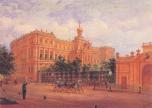
Kamennoostrovsky Avenue
KAMENNOOSTROVSKY AVENUE, located between Troitskaya Square and the Bolshaya Nevka River Embankment. The main thoroughfare joining the city centre and the Petrogradskaya Side with Aptekarsky Island and Kamenny Island
|
|
|
|
|
hidden
|
Kanareechnaya Street
KANAREECHNAYA STREET, running between Bolshoy Avenue and Sredny Avenue of Vasilievsky Island. The street was laid in the 1800s, near Gallery Harbour. It was originally named after house-owner and skipper S. Kanareev (building no
|
|
|
|
|
hidden
|
Kanonerskaya Street
KANONERSKAYA STREET, running from Lermontovsky Avenue beyond Angliisky Avenue. The street was laid in the 1740s. The original name, Shkiperskaya Street (1739), never entered everyday use, and the street was given its modern name in the 1770s
|
|
|
|
|
hidden
|
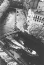
Karpovka, river
KARPOVKA (from Fin. Korpijoki, which means Forest River or Crow River), a river, separating Petrogradsky Island and Aptekarsky Island. The river is 3 kilometres long
|
|
|
|
|
hidden
|
Kazachy Lanes
KAZACHY LANES, Bolshoy Kazachy Lane and Maly Kazachy Lane, known as such since 1795 for the Don Cossacks Yard. Called Ilyicha Lane from 1925 to 1993. Bolshoy Kazachy Lane extends from Gorokhovaya Street to Zagorodny Avenue
|
|
|
|
|
hidden
|
Kazanskaya Street
KAZANSKAYA STREET known as First Perevedenskaya Street in the 1740s, Bolshaya Meshchanskaya Street from the 1750s to 1873, and Plekhanova Street in memory of G. V. Plekhanov from 1923 to 1998. The street runs between Nevsky Prospect and Fonarny Lane
|
|
|
|
|
hidden
|
Kaznacheyskaya Street
KAZNACHEYSKAYA STREET, running from Griboedova Canal Embankment and opening onto a different section of the same embankment after crossing Stolyarny Lane. The street was laid in the first half of the 18th century
|
|
|
|
|
hidden
|
Kima Avenue
KIMA AVENUE, between the Smolenka River Embankment and Uralskaya Street, on Dekabristov Island. Laid in 1914 during the development of the New Petersburg region
|
|
|
|
|
hidden
|
Kolokolnaya Street
KOLOKOLNAYA STREET, located between Vladimirsky Avenue and Marata Street. Constructed in the 1740s according to a project by the St. Petersburg Construction Commission
|
|
|
|
|
hidden
|
Kolomenskaya Street
KOLOMENSKAYA STREET, located between Kuznechny Lane and Volokolamsky Lane. The road was constructed in the 1740s, according to a project by the St. Petersburg Construction Commission
|
|
|
|
|
hidden
|
Kondratyevsky Avenue
KONDRATYEVSKY AVENUE (from the 1830s to 1918, Bezborodkinsky Avenue), located between Arsenalnaya Street and Mechnikova Avenue. It was built in the second half of the 18th century
|
|
|
|
|
hidden
|
Korolenko Street
KOROLENKO STREET (known until 1921 as Baskova Street, its owner"s name), is located between Nekrasova Street and Preobrazhenskaya Square. Laid out in the second half of the 18th century, it was renamed after V. G
|
|
|
|
|