|
|
|
Addresses
/
Kronverksky Ave/Saint Petersburg, city
hidden
|
Dobrolyubova Avenue
DOBROLYUBOVA AVENUE, running from Kronverksky Avenue to Bolshoy Avenue of the Petrogradskaya Side. Laid in the 1860s along the route of a filled-in section of the Zhdanovka River
|
|
|
|
|
hidden
|
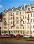
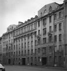
Kronverkskaya Embankment
KRONVERKSKAYA EMBANKMENT is located between Troitskaya Square and Kronverksky Avenue along the right bank of Kronverksky Strait. It was laid in 1980 and received its name after Kronverk at the same time
|
|
|
|
|
hidden
|
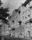
Kronverksky Avenue
KRONVERKSKY AVENUE, between Troitskaya Square and Mytninskaya Embankment, on the Petrogradskaya Side; its semicircular arch includes the territory of Alexandrovsky Park. The avenue was constructed in the first half of the 18th century
|
|
|
|
|
hidden
|
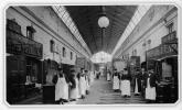
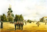
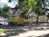
Markets (general)
MARKETS. Markets, especially food markets, were very popular in Russia as early as before the time of Peter the Great. The first market appeared in St. Petersburg in 1705 on Troitskaya Square with hundreds of stalls, but no windows or ovens
|
|
|
|
|
hidden
|
Mytninskaya Embankment
MYTNINSKAYA EMBANKMENT stretching from Kronverksky Avenue to Dobrolyubova Avenue along Kronverksky Channel and the Malaya Neva River in the southern extremity of Petrogradsky Island at the approach of Birzhevoy Bridge
|
|
|
|
|
hidden
|
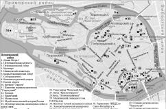
Petrogradskaya Side
PETROGRADSKAYA SIDE (in the 18th century - Gorodskaya Side, until 1914 - Peterburgskaya Side), the joint name of the territory that includes the following islands: Petrogradsky, Aptekarsky, Petrovsky and Zayachy
|
|
|
|
|
hidden
|
Petrogradsky District
PETROGRADSKY DISTRICT, an administrative and territorial unit of St. Petersburg, with its administration located at 19 Bolshaya Monetnaya Street. The district was formed in 1917, and in 1936 the Primorsky District was separated from its territory
|
|
|
|
|
hidden
|
Public Halls (entry)
PUBLIC HALLS, a special premise for informal mass events. The first public hall was arranged in banker A.A. Ral's house (On the Moika River Embankment, beside Red Bridge; not preserved)
|
|
|
|
|
hidden
|
Public Lavatory
PUBLIC LAVATORY. Since the early 18th century, primitive latrines were arranged on the territory of gostiny dvors, markets, ports, and along river and canal banks
|
|
|
|
|
hidden
|
Vvedenskaya Street
VVEDENSKAYA STREET, from Bolshoy Avenue of Petrogradskaya Side to Kronverksky Avenue. The street was known as Second Vvedenskaya Street in the 1730s-90s; from 1923 to 1944 it was called Rozy Luxemburg Street
|
|
|
|
|
|
hidden
|
|
hidden
|
|
hidden
|
|