|
|
|
Entries
/
Slavyanka, river
Slavyanka, river
Categories /
City Topography/Waterways and Currents/Rivers
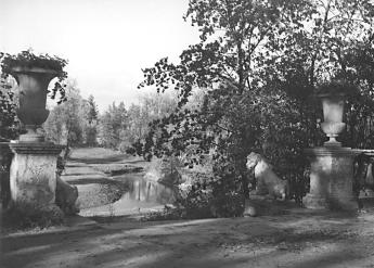
SLAVYANKA, a river in the south-east of St. Petersburg, a left tributary of the Neva River, which flows into the latter 27 kilometres above the mouth of the Neva. The head of the river if situated in the marshes 9-10 kilometres south-westward of Pavlovsk. The river is 39 kilometres long, with the width coming up to 70 metres in the lower reaches and the depth coming up to 1.5 metres. The average flow rate in the mouth of the river reaches up to 1.8 cubic metres per second. The area of the basin is 249 km2. The river-valley in the upper course above Pavlovsk is narrow and meandering, with the width of the channel coming up to 3-4 metres; the river flows in a rapid current. Farther on, the valley widens, and the width of the watercourse reaches 12-15 metres, whereas the current slows down. In Pavlovsk, the Slavyanka River drains the ponds of the palace and park ensemble. It is also used for water-supply and recreation. Below Pavlovsk, it flows again through an incut valley for three kilometres then tranquilly meanders along the Neva Hollow; it flows through the areas of Rybatskoe, Petro-Slavyanka and Ust-Slavyanka. A large tributary, the Kuzminka River, falls into the Slavyanka on the left. A number of railway bridges and highway bridges were built across the river; for example, Slavyansky Bridge and Rybatsky Bridge within the limits of St. Petersburg. The water of the Slavyanka is polluted, especially in the lower reaches of the river. Y. P. Seliverstov.
Addresses
Slavyanka River/Saint Petersburg, city
|